|
|
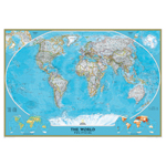
National Geographic's World map is the standard by which all other reference maps are measured. The World map is meticulously researched and adheres to National Geographic's convention of making independent, apolitical decisions based on extensive research using multiple authoritative source. The signature Classic style map uses a bright, easy to read color palette featuring blue oceans and stunning shaded relief that has been featured on National Geographic wall maps for over 75 years. Drawn in the Winkel Tripel projection, distortions are minimized and unlike many other World maps, Greenland is show the same size as Argentina and not as the size of all of South America. Thousands of place names are carefully and artistically placed on the map to maintain legibility even in the heavily populated areas of Europe, Asia and the Middle East. Details include clearly defined international boundaries, cities, physical features, rivers, and ocean floor features. Corner inset maps feature vegetation and land use, and population density as well as the north and south polar regions. Mural Maps are printed on a tear-resistant, coated paper to achieve a combination of exceptional strength, color protection, and long life. Mural Maps can be hung using heavy duty (clay based) wallpaper paste. The map is coated to resist dirt and dust and may be cleaned with a slightly dampened cloth. Measures 110 x 76.5. Scale 1:12,510,000 - This extraordinary mural-sized world map features the Winkel Tripel projection to reduce distortion of land masses as they near the poles
- Shows subtle border coloring on land, and prevailing winds and ocean currents at sea
- Separate insets show the North and South Polar regions, world vegetation and land use, and world population density
- Enjoy the accuracy and beauty of the latest world map from the cartographers at National Geographic. Map is printed on premium quality paper!
NON-RETURNABLE: This item is non-returnable
|
Log in for Price
NGMRE00622007
|
|
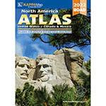
Kappa Map's 2022 North America Deluxe Road Atlas just got even better! Still featuring over 52,000 cities in the United States, Canada and Mexico more than most other atlases available with same page indexing. Includes over 350 detailed City insets. This Atlas includes a special section on State Spots for your best Social Media photos. In addition, we've included QR codes for each state Department of Transportation web site. Just scan the code with a smart phone and have weather, traffic and construction information at your finger tips! GPS compatible longitude and latitude grid information. 144 Pages. - Still featuring over 52,000 cities in the United States, Canada and Mexico more than most other atlases available with same page indexing
- 350+ Detailed City Inserts
- This Atlas includes a special section on State Spots for your best Social Media photos
- GPS compatible longitude and latitude grid information
- 144 Pages
NON-RETURNABLE: This item is non-returnable
|
Log in for Price
UNI14998
|
|
Together, let's ignite a spark of knowledge by exploring the wonders of learning with our new educational placemat! Our placemat is designed with colorful illustrations and fun educational activities that make learning enjoyable for kids. Each activity includes an interactive exercise that encourages creative and critical thinking through educational topics. Plus, its easy to store and clean! So lets create a stimulating learning environment with our new educational placemat today! Pack of 10 placemats. - Use with dry erase or water based markers and washable crayons
- Water resistant, no lamination required
- Write-on/wipe-off surface
- Great for early learning
NON-RETURNABLE: This item is non-returnable
|
Log in for Price
ASH95700
|
|
Together, let's ignite a spark of knowledge by exploring the wonders of learning with our new educational placemat! Our placemat is designed with colorful illustrations and fun educational activities that make learning enjoyable for kids. Each activity includes an interactive exercise that encourages creative and critical thinking through educational topics. Plus, its easy to store and clean! So lets create a stimulating learning environment with our new educational placemat today! Pack of 10 placemats. - Use with dry erase or water based markers and washable crayons
- Water resistant, no lamination required
- Write-on/wipe-off surface
- Great for early learning
NON-RETURNABLE: This item is non-returnable
|
Log in for Price
ASH95701
|
|
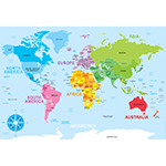
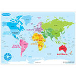
Smart Poly™ material has been designed for the classroom and home. The material is strong, durable, water resistant, and does not need lamination. Practice learning world geography with the World Basic Map learning mat. Label countries and bodies of water. Heavy duty double-sided surface for fun and colorful learning on both sides. Write-on/wipe-off surface. Use with dry erase or water based markers and washable crayons. Each side is an interactive lesson. Mat measures 12 x 17. Pack of 10 learning mats. - Heavy duty double-sided surface, no lamination required
- Use with dry erase or water based markers and washable crayons
- Water Resistant
- Colorful designs on both sides
- Measures 12 x 17, pack of 10 learning mats
- Geography
NON-RETURNABLE: This item is non-returnable
|
Log in for Price
ASH95602
|
|
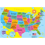
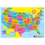
Smart Poly™ material has been designed for the classroom and home. The material is strong, durable, water resistant, and does not need lamination. Practice learning geography with the U.S. Basic Map learning mat. Label states, capitols, major cities and bodies of water. Heavy duty double-sided surface for fun and colorful learning on both sides. Write-on/wipe-off surface. Use with dry erase or water based markers and washable crayons. Each side is an interactive lesson. Mat measures 12 x 17. Pack of 10 learning mats. - Heavy duty double-sided surface, no lamination required
- Use with dry erase or water based markers and washable crayons
- Water Resistant
- Colorful designs on both sides
- Measures 12 x 17, pack of 10 learning mats
- Geography
NON-RETURNABLE: This item is non-returnable
|
Log in for Price
ASH95600
|
|
Over 50 Reproducible Maps! This resource contains up-to-date maps of countries and regions of the world. It is designed to supplement geography studies. Includes illustrations of world continents, countries, and bodies of water. 64 pages. - This resource contains up-to-date maps of countries and regions of the world. It is designed to supplement geography studies, as well as develop a more comprehensive understanding of the geography of the world. Over 50 maps. 64 pages
- Over 50 maps.
- 63 pages
- develop a more comprehensive understanding of the geography of the world
NON-RETURNABLE: This item is non-returnable
|
Log in for Price
OTM118
|
|
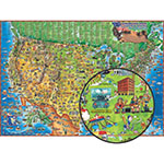
This illustrated map of the United States has over 500 illustrations of points of interest across the USA! It has state capitals and other educational information, inluding a Find then Answer feature. Measures 38x54 and is laminated. - Laminated
- Map measures 38x54
- Hundreds of Illustrations
- It has state capitals and other educational information, inluding a Find then Answer feature
- Hours of Fun!
NON-RETURNABLE: This item is non-returnable
|
Log in for Price
RWPDM005
|
|
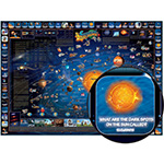
From planets, to stars, to historical satellites and other events in space, the hundreds of elements and points of information will teach about space like no other tool. This laminated map measures 38 x 54. This map has a 'Find Then Answer' feature! - Beautifully designed, educational, and playful map
- Laminated for long lasting use
- Great for kids room
- Measures 38H x 54W
- Beautifully designed, educational, and playful map;Laminated for long lasting use;Great for kids room;Measures 38H x 54W
NON-RETURNABLE: This item is non-returnable
|
Log in for Price
RWPDM006
|
|
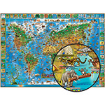
This laminated animals map is loaded with hundreds of animals, both well known and obscure, depicted in their geographically accurate locations and individually labeled. Features a chart of animals along the edge of the map. Measures 38H x 54W. - Beautifully illustrated animals map
- Laminated for long lasting use
- Edge chart of animals
- Great for kids room
- Measures 38H x 54W
NON-RETURNABLE: This item is non-returnable
|
Log in for Price
RWPDM002
|
|


